|
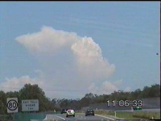
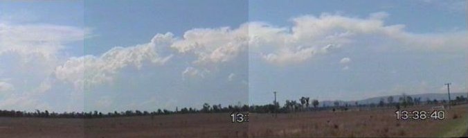
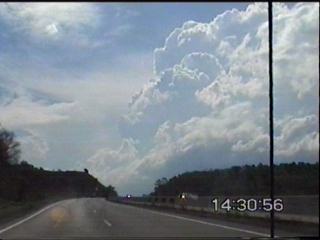
Severe Hailstorm & Supercell Chase Produces WC & Funnel!!! November 4, 2000 Saturday the 4th of November was shaping up to be yet another great day for severe thunderstorms in SE QLD! With the trough still lingering just inland, moisture from the previous two days of storms, and lack of low level cloud, it was sure to be impressive! And indeed, it didn�t disappoint! Physical LI values on this day dropped to around negative 8, and shear was ever so slightly better! By 10:30am, TCU was already popping up on the Cunningham Ranges, by 11am the first cell had anvilled out!
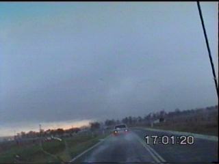
After refueling my car, and getting my morning Ribena Berry popper from the service station, I was on my way! I decided to head for the Rosevale area. I had discovered that this village was located on the foothills of the Cunningham Ranges, the views from this area were quite good, and surprisingly for a remote area, the mobile coverage was superb! I watched the cells over the Cunningham Ranges continue to pulse, move of and dissipate, and was waiting patiently for one to move off and maintain intensify.
The cells were reasonably
lightning active, with rumbles of thunder every 30-60 seconds from them.
Finally one cell started to get going and moved towards the NNE off the
ranges towards the Rosewood district. I headed north to follow it,
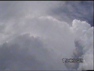
and observed some nice hail shafts soon to develop, and some weak mammatus
in the anvil.
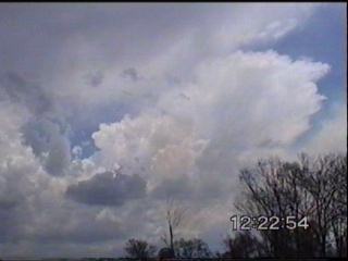
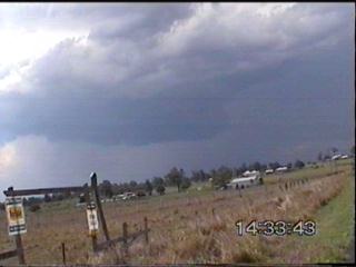
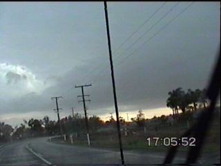
I got some distance north of this cell before finally stopping, changing my underwear and looking back at the storm. To my dismay, the updraft region was looking sick, and it looked like cell had lost a fair bit of grunt. However new cells were forming to my NW, over the Brisbane Valley-Crows Nest region! The updrafts on these cells were very strong, and they were producing thick anvils.
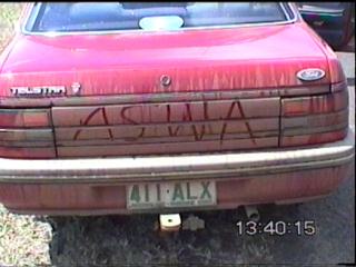
Static on the am was increasing rapidly, and with weak cells starting to clutter up the Cunningham Ranges region, I decided to head north, even though the cells would normally move into unchasable territory. But not before looking at the back of my car, and engraving the name of an association that I�m proudly a member of though! (Australian Severe Weather Association http://www.severeweather.asn.au )
One cell in particular caught my attention, it seemed to be moving towards me! I wasn�t sure if this was right, as most cells move NE, not SE! However a phone call from a good friend of mine giving a radar update confirmed that one of the cells had actually split, and this was the right mover! It looks impressive for a right mover, in my experience most right movers don�t last very long, but this had a well organised flanking line, and from a distance (50km) looked like a very strong thunderstorm.
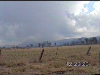
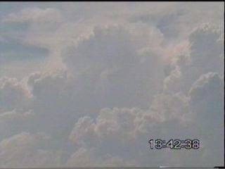
I shot NNW in the hope to try and get close enough to this cell, as I got a better view, I was starting to notice a lowering under the main updraft of the cell! However I couldn�t tell as I had small area of hills near Marburg in the way! However I finally was able to get a glimpse, and what lay underneath was a lovely circular war cloud!
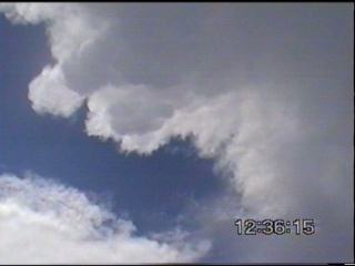
(However the video footage does not show this well), I took a few snaps and continued onwards to finally get around the Marburg area, and onto a side road to the north of the Warrego Hwy with expansive views. This cell was awesome!!! The wall cloud was still present, although not nearly as photogenic, I could make out one definite area of inflow with another possible area at the back that I could not see.
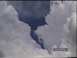
As the wall cloud ascended, I continued to watch, and then watched to my NE as what appeared to be a distant funnel cloud in the distance descend! It was difficult to make out, and is quite a distance, however I was able to zoom in on the video camera nicely. It was not possible to tell whether this reached the ground or not due to the hills and trees in the way!
The flanking line of this cell continued to form virtually in front of me, and as the storm continued to track in a ESE-SE fashion, I continued with it. Near Minden, I stopped and watched the flanking line of the cell, the new updraft had a nice corkscrew in it! As it ascended, you could see it rotate and curl!!! It looked quite impressive (yet also slightly concerning at the time as I was virtually just 500m away from being directly under that region).
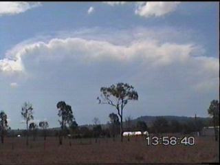
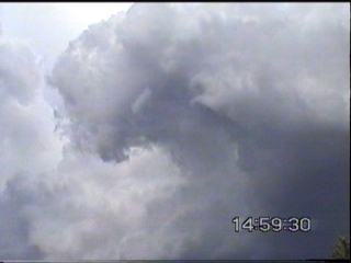
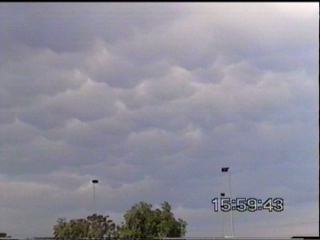
The updrafts of the actual cell looked circular too, this was certainly a very nice supercell I thought! I continued eastwards towards Ipswich and the Brisbane western suburbs, the mammatus was quite impressive (the best stuff not on film though, as per usual!)
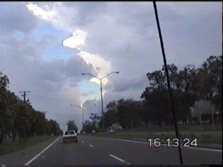
However, as I looked for a place to shelter with the storm, it collapsed and died just before it reached civilization! Although one inch hail was reported in the Mt Crosby region. I headed back out to Ipswich and caught a glimpse of a rapidly developing cell just to the west of Ipswich. This cell very quickly had very strong rainshafts, and a weak guster region.
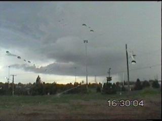
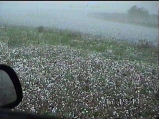
I could see a better cell behind it, but once more I got stuck in Ipswich and I tried to get out and head south (after being informed this larger cell was also moving SE), but instead another area of cells overtook me that gave very heavy to torrential rain and two lots of pea to one centimetre size hail! Cars were taking shelter under overpasses from the rain and hail. It was yet more chaser convergence when I was trying to work out what car was following me and stopping whenever I stopped, but soon cottoned onto it being Damien Howes! We pulled over in the 2nd bout of hail, and watched the hail bounce on the side, with a few nice bolts of lightning to watch and hear! We continued south, and between cells we briefly caught up and talked, we saw the cell that I saw earlier, and it was still looking very strong!
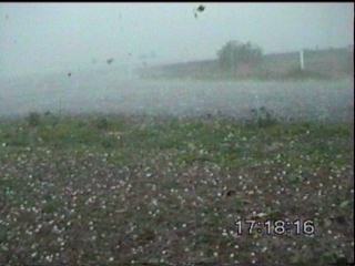
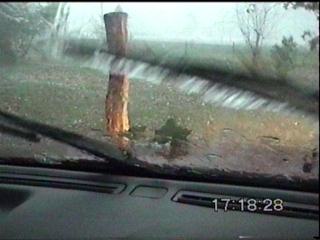
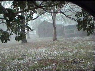
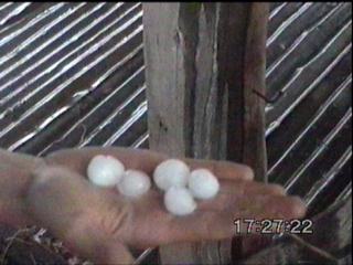
I wanted to get ahead of it, and hopefully stay ahead of it to Beaudesert, however it wasn�t to be! As we headed south, even more chaser convergence with Ben and Jason catching up with us! This cell though soon caught up with us, and very soon we got into some moderate rain ahead of the gust front. As we were continuing along I heard a very loud thump on the car, I thought �I hope that is a loose stone being kicked up, and not hail� � at the same time another very large thump � oh no! Within seconds, the gust front went through with winds around 80km/h and large hail (to 3.5cm!) pounded the cars. Jason and myself turned around and took shelter near a shed/area of trees from the hail. I parked near some trees, I was worried they could be blown over/struck by lightning, but decided to take the risk! I was expecting one of the windows to crack any minute, with the thumps of the hail being incredibly loud on the car! I was frantically trying to video tape this, and was watching as branches and leaves fell onto my car being shredded by hail and winds!
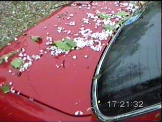
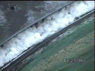
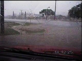
Fortunately the strong winds didn�t last for long, but the hail continued for much of the duration of the storm. We all stood in a small abandoned farm shed as we witnessed numerous close CG�s, and looked at what was now hail that blanketed the ground! Most of the hail was around an inch in size, with the largest we found measuring 3.5cm, not huge hailstones, but with the strong winds it was enough to put a few small dents and scratches on my car! But nothing major! I left Jason and Ben and looked for larger hailstones but couldn�t find any. I decided to stick with my original plan and head east. However on the way to Beaudesert, I got yet another fright as I came around a corner, to have a tree lying across part of the road! There was an oncoming car passing by at the time, so I couldn�t swerve, and the breaks were slammed on as I skidded towards it! At the last minute though, I was able to do a small swerve only clipping the edge of the branches � again no damage to the car which was the main thing! Towards Beaudesert I had yet more torrential rain and hail, hail was much less infrequently then just south of Peaks Crossing earlier, but stones were up to 2cm in size. I observed flash flooding at Beaudesert with the storm water drains not coping with the intense precipitation.
I got out of the area of precipitation and hung back, I observed some very nice, but infrequent CC and CG bolts, before everything seemed to have weakened. It was now time to head back north on the Mt Lindsay Hwy back home, but this was not made boring by the lovely lightning show to the north from storms still continuing! Another fantastic
day of chasing, although admitting things did get a little hair-raising
at times! Thanks to Dr Pearce, Ross Portas, Dann Weatherhead and
Paul Graham for updates!
Chase
Report by Anthony
Cornelius
|