During Friday, October
the 13th an extensive cloud band was moving across eastern Australia.
This was in response to a strong upper level trough moving through, and
a frontal system behind this. Some extremely large thunderstorms
formed ahead of this in NW QLD during this day.
During the night, the cloud band continued to move quickly offshore, by
the morning the cloud band had actually moved ahead of the front and a
dryer slot had occurred just behind, with pre frontal trough and front
behind that again. At 7:30am, the front was located near Warwick,
but due to the speed of it, it was going to move through Brisbane in the
next two hours or so. With the clearer air and strong northerlies
(20-25kn) ahead of it, I decided to head out towards the SW of Brisbane
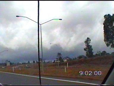
in the hope that a squall line would form. By 9am, I was out of Brisbane
and on the Cunningham Hwy heading towards the SSW.
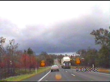
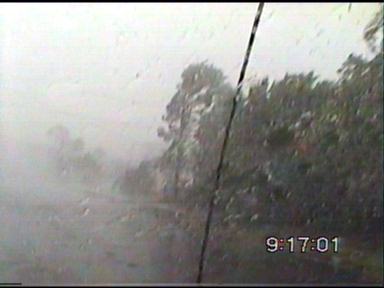
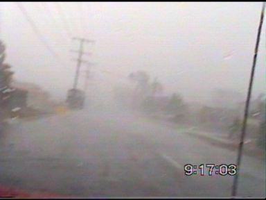
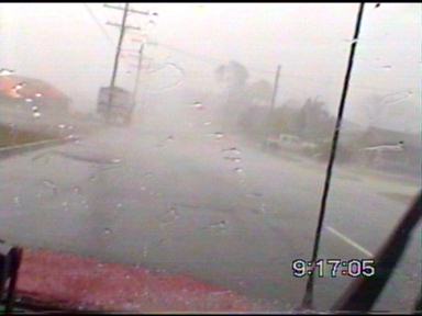
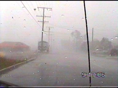
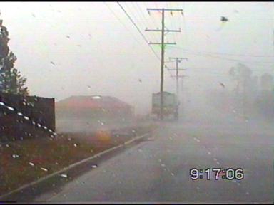
I very quickly came into view of a nice frontloading gust front, and stopped to take some captures. It was moving through very quickly! I experienced strong winds around 60-70km/h as it passed over! The rain was only moderate though, but was made heavier by the stronger winds.
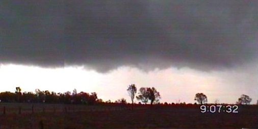
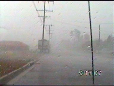
I headed back up north on the Cunningham...it was still windy, and the rain was still moderate, but appeared heavy due to the winds. Following this back up north for 5km or so, I got some torrential rain and more strong winds on the highway! A few cars had pulled off the side of the road, but it was still drivable (just) while doing about 60km/h. I finally got ahead of the line, and wanted to get a better look at it again. I took the Ripley Rd exit and headed west for a couple of hundred metres when I came too close to a vortex I rather would have stayed away from! I entered an area of strong winds and rain, and then they suddenly increased to around 50-60 knots! At the same time, a spinup vortex crossed the road in front of me, which threw my car to the left, as well as physically slowing down the car due to the force of the wind!!! This moved very quickly, and followed with 10-15 seconds of winds around 20 knots before going nearly calm!
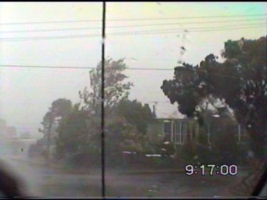
The vortex is difficult to make out on video, however there are a few things that indicate that the vorticity is present in the higher levels hence meaning that eddy vorticity is unlikely. Survey of damage afterward shows an area of more damage, surrounded by lesser damage. There were generally lots of small twigs and branches blown down, but in this area, and a small path lasting for about 500m, an area of more damage with small trees, very large branches down, as well as signs bent over and a port-a-loo knocked over! A few interesting things to note, is the movement of a branch that is at the same height as the power lines. This appears to move from the east and curving around to eventually move north! Straight line winds wouldn�t have done that, and any straight line winds present would have been from the SW! The branch most probably came from trees behind the car, as there were no tall trees to the SW or S of the branch debris flying through the air. In summary, this tornado was a F0, only very weak (fortunately for me), and is a reminder of how careful you need to be when storm chasing! This was actually what is nick named a "coldie" read below for some more information on this setup.
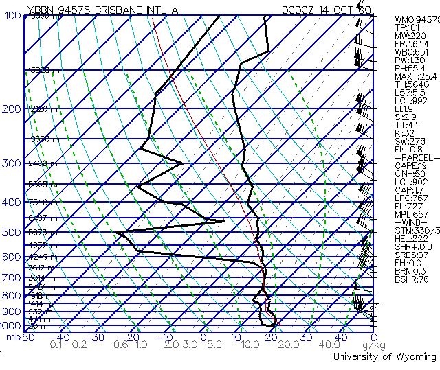
Skew-T diagram courtesy of University of Wyoming Shear was ideal for tornadoes (cold air tornadoes) during this day with 20-25kn northerlies ahead of a gale force SW�ly change. The low level shear was also very strong with WNW winds at 850mb of 45kn! SRH on the sounding was 222, which is quite significant and indicates quite favourable shear for tornadoes in the low levels! There were numerous other reports of tornadoes and vorticity from this squall line. A possible tornado was believed to have been sited from the Brisbane CBD, another was photographed at Redcliffe (chase report here), and strong vorticity was present over the Wynnum-Manly area! No doubt other funnels, tornadoes and areas of vorticity could have occurred but were not reported!
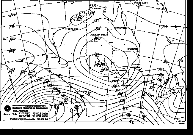
MSLA courtesy of the Bureau of Meteorology Certainly an extremely
interesting event that is generally more common in the southern states
of Australia. However it made a nice change to what had been a fairly
dry and warm weather with an absence of thunderstorms (apart from October
10). Wow � I never once imagined I�d drive into a tornado, and don�t
want to try that in a hurry either!!!
Chase
Report by Anthony
Cornelius
|