|
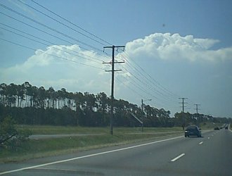
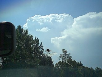
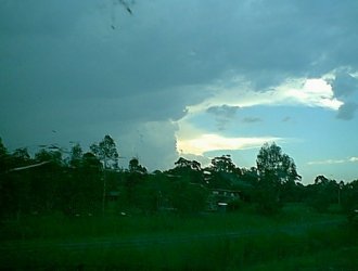
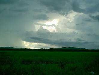
Sunshine Coast Storm Chase - January 22, 2000 The day started off with full overcast at my location. A look at the morning MSLP chart showed that a trough had moved through Brisbane, and was now cutting the southern QLD coast around the Maroochydore area (north of Brisbane). Some models were forecasting another trough to form down through inland parts of SE QLD during the day, and i was desperately clutching onto this forecast if there was to be any chance of storms for Brisbane! By 10am or so the cloud began to clear, and it was warming up. By about midday i could see the first decent convection of the day to my NW. I was working on some webpages and clowning around, and didn't really look at the sky for another hour. When i went outside again around 1pm, i was greeted by the sight of 2 or 3 weak storms to my not so distant NW. I didn't have much petrol or money to put petrol in the car, so i thought i might just go to my vantage point on the northern side of Redcliffe (northern suburbs of Brisbane) and observe the storms. So off i went, but i just couldn't help myself! The storms were weak at first, but by the time i left the house they were starting to show some potential , and instead of taking the turnoff to my lookout, i took the turnoff to the highway to go north. As the series of photos below shows, the storm steadily gained intensity as i traveled north (these shots taken over a 10-15 minute period).
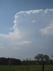
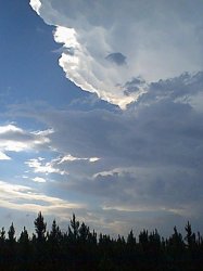
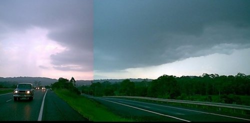
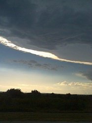
It was really starting to look promising now, and i decided to head further north. The Bruce Highway from northern Brisbane to the Sunshine Coast travels through several Pine Forest plantations, so my storm view was severely limited for the next 10 minutes or so. I took the Glasshouse Mountains turnoff as i knew there was a great clearing just off the highway, and i was greeted by a great crisp anvil shown below!
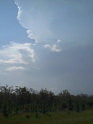
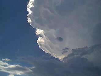
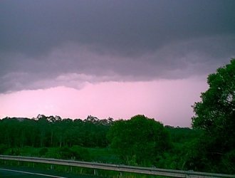
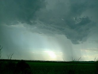
Even though i had only a small amount of petrol, i thought bugger it! I'll keep chasing this storm. This was definitely a good decision, as i was only a few Km's down the road when the sun went behind the anvil, and the storm took on a great appearance as shown below.
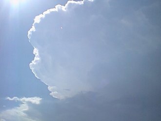
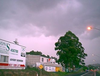
At this stage the storm was definitely quite strong, and i was eager to see what the Gust Front looked like. The only problem was that for the past few days all storms that developed were pulse storms due to lack of shear, and were lasting between 20 and 40 minutes. The storm had only just got organised, but if i wanted to see a decent guster (i'm a BIG guster fan) i knew i had to haul ass north. So off i went. About 15 minutes later i pulled over to photograph a very weak looking shelf cloud on the eastern side of the storm. Even though this picture turned out poorly, and it did look a lot darker and a bit meaner in real life, it was still not what i was hoping for!
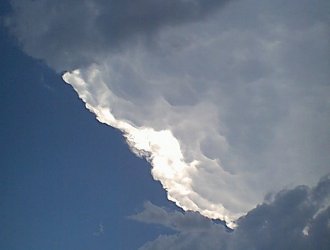
I noticed that there appear to be quite a lot of precip to the NW of this feature, and a rather crisp and steep edge to the northern side of the storm. Thinking that the best guster was still to come, i took the harry northwards again. I passed the Caloundra and Maroochydore turnoffs, and kept going north, with the following image on the horizon.
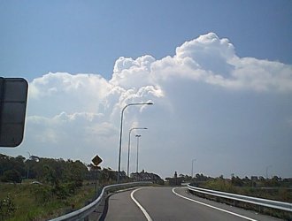
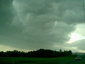
I finally managed to get ahead of this storm, and i didn't have to wait long until the gust front appeared. Looking back as i was driving north, the anvil of the storm appeared to be weakening somewhat, and i wasn't really expecting to see the gust front at full strength. It still looked nice though! At this time the storm was yellow on radar, showing pink intensity 10 mins earlier, and red intensity 10 mins before that - so it was definitely in a weakening mode.
I decided to try and stay ahead of the storm. The road network around the Sunshine Coast is actually very very good, although in some parts it is very forrestry and your view of the horizon can be very limited. I drove through an area like this, with the storm following closely behind me. There was a lot of traffic too, and i wasn't really getting any further away from the storm, but merely staying just outside the heavy rain curtain. I finally found a spot where i could take some pictures (shown below). I continued to try and stay ahead of the storm. The traffic eased a bit, and i was able to gain some ground on it. As i approached Maroochydore, i found a good place to take some pictures. The storm appeared to have strengthened somewhat at this stage, with the gust front taking on a much different appearance, and lightning activity had increased slightly. I took some more snaps.
This was short lived though, and by the time i found another spot to take some pictures while staying ahead of the storm, it had weakened significantly and there was very little lightning. I took some more snaps.
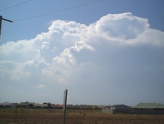
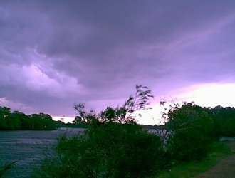
At this point i noticed some very large rain free bases to my north. This storm was now well on its way out, and i decided to head north to get closer to the RFB's. I stopped on the banks of the Maroochy River to take some more snaps. There was also a nice storm to my NW (second picture below) that looked like it had potential.
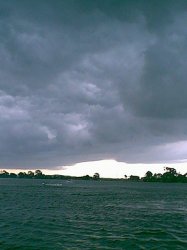
I decided to keep heading northwards. 10 minutes or so later i stopped on the side of the highway and took the following snaps. I was running out of go go juice! And i wasn't sure if i had enough to get me back home, so i decided to sit at this location for a while and observe the storms.
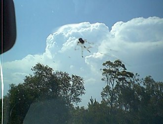
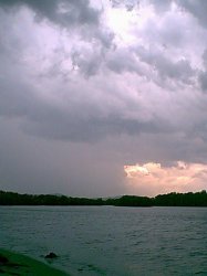
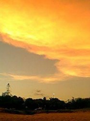
For the rest of the afternoon i remained close to this location. There appeared to be a large storm complex to the north, with the anvil cirrus in that direction thickening up dramatically and it was just plain pitch black! However, i was really pushing it being so far north with very little petrol left, so i decided not to risk a walk home by going any further north. After inspection of Radar and Lightning Tracker that night, i really wish i had more petrol to go north! Radar indicated a very large an intense storm around 50km to my NNW, and the lightning tracker was going spastic - recording almost 1000 Cg's in a 5 min period at one stage. I took the following pictures during the late afternoon, and at Sunset.
Click on any thumbnail to see a full size version Chase report by Ben Quinn |