|
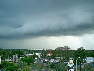
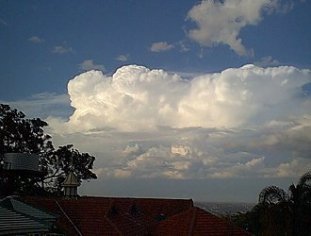
SEVERE THUNDERSTORMS IN THE SE QUARTER OF QLD - JANUARY 5, 2000 The model forecasts for Wednesday in the SE quarter of Queensland were looking promising, with -6 LI's and CAPES in excess of 2000. They day started off quite ordinary in Brisbane, with some horrible dry looking Cu around, but during the afternoon things began to look much better, and before long storms began to develop. Some of these storms were severe, with reports of 50 knot winds at the Taroom Powerhouse (roughly NW of Brisbane), and 11 houses damaged in Brisbane (mostly from trees falling on houses). There was even a report of a funnel cloud from a spotter in the Boonah shire! There were also reports of hail (up to 10 cent coin size) reported from several Brisbane suburbs. This Severe Thunderstorm Warning was issued by the Bureau of Meteorology late in the afternoon
Brisbane Storm Chasers Anthony Cornelius, Jonty Hall, Ross Portas and myslef (Ben Quinn) were chasing SW of Brisbane on this day. Click here or on any of the above photos to see the report. Report
by Ben
Quinn
|