|
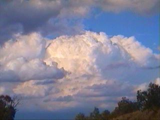
SEVERE HAILSTORM BATTERS LAIDLEY AND BEAUDESERT- MAY 17, 2001 *A new realtime storm information page has been added to this site. Click here to see it* A combination between a surface trough and an approaching upper level trough caused showers and storms to develop in SE QLD. Given the time of year the upper levels are quite cold, which meant that any strong storm was likely to produce hail. Storms began to develop near Crows Nest (WNW of Brisbane) early afternoon, and before long they became quite strong moving SE towards the Ipswich/Laidley area. Just after 3pm the BOM issued the first severe thunderstorm warning.
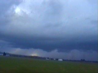
This storm moved through the Laidley area with strong winds, heavy rain and copious amounts of hail. The BOM continued to issue warnings for the storm as it continued SE towards the Beaudesert area, where it produced more torrential rain, copious amounts of hail and winds strong enough to "flatten trees" as described by employee's of the Beaudesert Meatworks.
Anthony
Cornelius was chasing this storm. Click here
or on the
Report by Ben
Quinn
|