

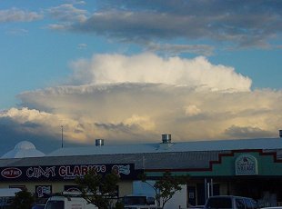
SPECTACULAR PYRO
CUMULONIMBUS AND ISOLATED STORMS - JUNE 20, 2001
Very cold air aloft and reasonable surface
temperature and moisture made the atmosphere unstable through much of the
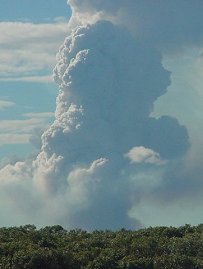
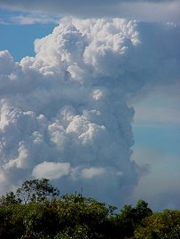
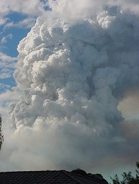
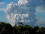
eastern half of SE QLD on this day, but the heat generated from a small
fire on Bribie Island during the afternoon made the atmosphere extremely
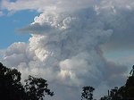
unstable directly above the fire, and a spectacular Pyrocumulonimbus (a
storm cloud which develops above a fire) developed. The updrafts
billowed into the atmosphere with such force that it gave the appearance
of a Volcano erupting! It even produced it's own rain! (observed
on radar) and static was heard on AM radio several times so it could have
been producing it's own lightning, although there was a storm to it's WSW
and it was impossible to tell where the static was coming from.
Click on any thumbnail to see a full sized
version
A full series (10 photos) of this Pyrocumulonimbus
can be found here.
Use the next/previous links to scroll
through the series.
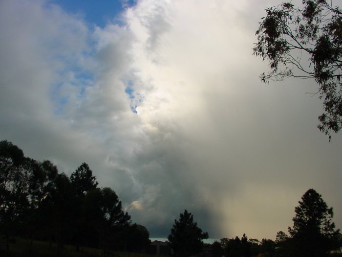
Showers and thunderstorms also developed
in other areas. A summary of the day at Coomera from Jason
Rainforest is below.
What a surprise!! Storms in Winter?
Bring that on ;). Today started like a normal Winter day, slow to warm
up, cloudless, and relatively boring. Storms were the last thing on my
mind..
I did notice however, around midday, rather
interesting congestus formations. The tops were folding over themselves
like mushrooms. I didn't take any pics as getting Emperor and Quake 3 working
in Windows seemed more important at the time. The congestus persisted to
early afternoon.
I drove to work around 1pm, nothing interesting
to see. By 2:30pm though, while I was mowing, I noticed a nice shower to
my SW. Last time I mowed something very similar happened (hehe, that'd
be right ;)), but I didn't expect a low topped hail storm today. Think
again..
The shower intensified and developed something
resembling a gust front, and had a nice RFB (rain-free base). There appeard
to be some rotation/swirling in this base, which was rather interesting.
At one stage I detected a green tint. The shower moved closer, still developing.
It started to rain.
The drops were very large. I thought there
may be hail in this shower. The rain came in waves for a while, then stopped.
The shower moved south of me.
I was disappointed slightly, but as I continued
to work, *bang* .. Thunder!!! Now this I didn't expect!. I counted up to
14 occurences of thunder, then it became continuous. At this point, I started
taking pictures and recording audio clips..
Click on any of the thumbnails below to
see a full sized version
Thunder MP3's - all between 100 and
260k

I wanted to leave work at this time, but
I couldn't. After work, I went to my lookout to watch the storm go offshore.
There was some nice lightning in it. When I got home, mum told me that
we got pea sized hail from it, I just missed it at work! She didn't save
any for me in the freezer, though I did ask her to do so in future.
What a great way to end a day! Need more
of these :).
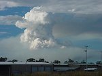
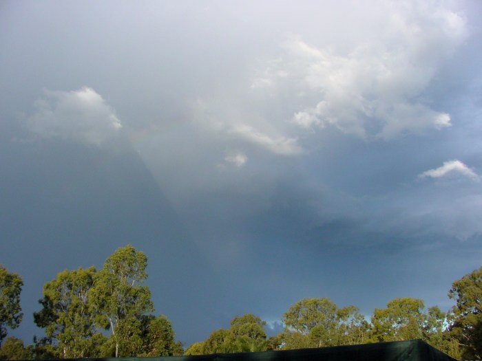
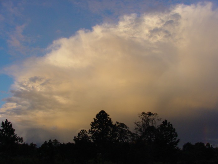
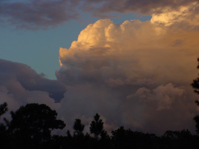
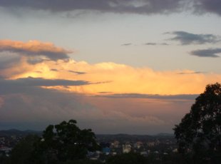
The first photo below was taken
by myself from Redcliffe, looking SSE late in the afternoon (great structure!)
and the second at sunset from Mt Cootha by Greg
Curtis.
Click on any thumbnail to see a full sized
version
There were several other reports of small
hail, including one from Steve
Baynham of pea sized hail for 5 minutes at Currumbin along with
strong winds and rain heavy enough to cause some local flooding.
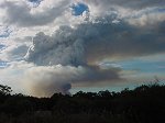
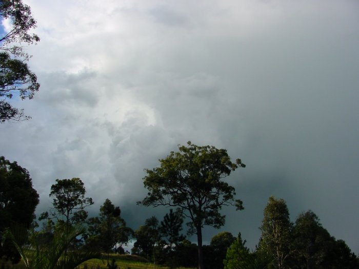
Cabolture also recieved 20mm in 20 minutes from a storm mid afternoon (click
here
for a photo of this storm approaching Cabolture).
|
