
 SEVERE STORM TEARS THROUGH
THE SUNSHINE COAST HINTERLAND, DECEMBER 30
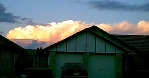
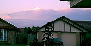
Storms had been forming
quite well near Sydney and to the north into the Hunter, with a very large
and severe supercell hailstorm lasting over three hours in the region.
Smaller thunderstorms had also been forming in NE NSW, but it wasn't until
just after 4pm that a small line of cells near Gympie started forming in
the maximum surface heating of the day. Initially these cells were
weak, and were moving ESE, but one cell gained strength and broke away
from the others, heading SE towards the Sunshine Coast at around 5:20pm.
It continued its path, and soon had maximum intensity on radar, and sustained
that intensity for nearly one and a half hours! The Bureau of Meteorology issued a severe thunderstorm warning for the district as damage
reports came in:
|
SEVERE THUNDERSTORM
WARNING
Issued by the
Bureau of Meteorology, Brisbane
at 6:31pm EST
on Thursday
the 30th of December
1999
For the Southeast
Coast District
A severe thunderstorm
near Maroochydore is moving southeast and is expected to affect
areas along the southern Sunshine Coast and adjacent hinterland over the next hour.
People are advised to secure outside items, move cars under cover and
seek shelter.
|
It was reported as
a "mini tornado" by residents and the media, with damage to trees, and
some structual damage to houses. There were reports of hail,
particularly in the farming districts on the outskirts of the Sunshine
Coast, where there was crop damages.
John
Woodbridge surveyed the damage, and sent this report to the aussie-weather
email list:
Narrow damage
path observed at the Mooloolaba turn off and a second path about 500m wide
about 4 kms North.
Damage confined to
trees and sporadic, the largest being broken branches and snapped trunks
to about 12" in diameter. One 4m Queen palm snapped off at ground
level. One road side hoarding demolished. Council were on the
job with the wood chipper cleaning up. All tree damage obviously
caused by wind from the same direction, i.e., NW wind which corresponds
to the storm track which was towards the SE. No tell tale signs of
hail (i.e., no shredded leaf litter), no sign of rotating wind.
As the storm spent
most of its time outside of local radar, it was difficult to tell whether
the storm was supercellular or not. However shear was definately
supportive of supercells, and supportive of right-moving supercells
if one were to occur. If this storm was actually a supercell, it
would have been a right moving supercell. However, due to limited
radar coverage, it is difficult to tell.
|
