|
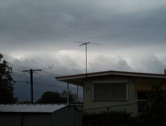
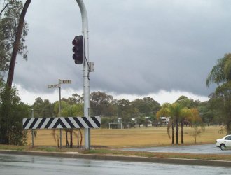
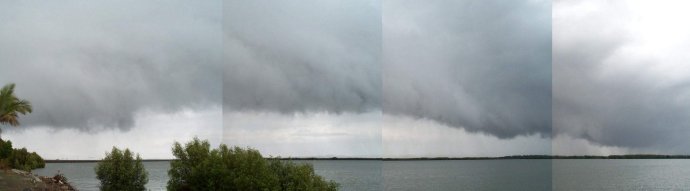
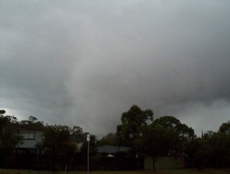
Early Morning Severe Squall Line - October 14, 2000 Click on any thumbnail to see a full size version I awoke to a fully overcast sky, with periods of rain - not exactly great storm conditions! However, there was low cloud racing in from the north at a great rate of knots, and it appeared that if storms did develop there would be sufficient shear to make things interesting. More intense echo's started forming on radar well SW of my location, and before long a squall line developed (click here to see Anthony Cornelius' chase story for this line). At first it all looked rather tame from my location, with a wall of only slightly dark high cloud approaching - but this soon changed, with a small band of rain clearing away and revealing some very nice updrafts! After wasting 15 minutes trying to get the car started, i was finally off. A gust front was soon in view.
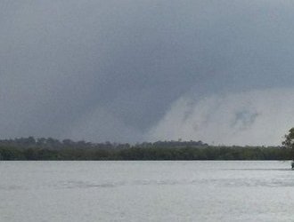
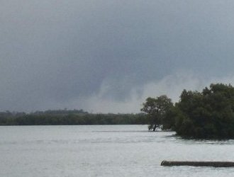
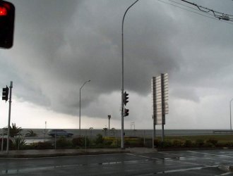
On my way south to a lookout, in between trees and houses, i spotted a funnel shaped lowering extending all the way to the ground! I went to take a picture, but had to wait for my digital camera to load up, and by that time the lights i was sitting at had been green for quite some time, and i was getting many beeps from aggravated drivers behind me in the heavy traffic, so no pictures from this location. I drove as fast as possible to one of my lookouts - this took about 2-3 minutes. When i got there, the cone shaped lowering was still there, but it was starting to retract into the cloud base. I took one picture, then another 20-30 seconds later.
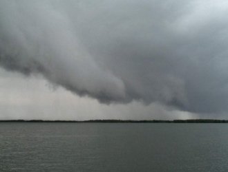
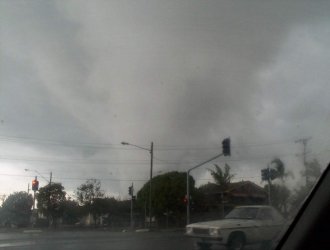
Quite hyped about the fact that i may have just seen a tornado, i began snapping pictures of the gust front that was now rapidly approaching me. The movement on this front was just mind blowing, with scud being rapidly sucked up into it, but there wasn't any rotation visible at this point. As you can see in the last picture below, quite a spectacular prong type feature developed. Although scud was once again being rapidly sucked up into this feature, there was no rotation.
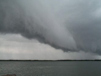
The whole line was moving very very quickly, and within 5 minutes i had to move to a different lookout in order to stay ahead of it. As i left, i took the first picture below - which is taken looking SE. I drove NNE for a couple of minutes, and then took the second picture below. As you can see, another quite spectacular arcus feature is developing! .....and then the third picture! No that's definitely not a tornado, it's a gust front arcus feature, but it was doing a great job of pretending to be one. There was no rotation at all in this feature. It quickly dissipated, and by the time i got down to the beach (only 1-2 mins later) it was gone.
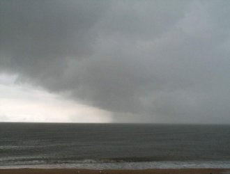
The line quickly moved offshore, showing a turbulent back end.
Click on any thumbnail to see a full size version
Written
by Brisbane Storm Chaser Ben
Quinn
|