|
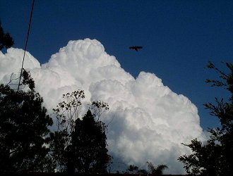
Another Winter Storm Chase! - August 23, 2000 As with the last few systems before this day, it was a bit iffy. Our main problem seemed to be moisture - NW winds were forecast, and it looked doubtfull that they would be moist enough for storms. But instead we got NE winds, and the day turned from 'marginal' to 'action packed'. The morning started off quite warm (for the time of year), and by mid morning some promising convection had developed. I was able to chase the whole day, but going by the forecast charts/my own observations, i wasn't going to need to go very far at all. I was doing chores around the house, but still keeping a close eye on the sky, when i noticed some very healthy looking congestus to my SW. I jumped in the car and headed towards one of my lookouts. In the time it took me to get in the car and drive 2k's down the road, the congestus had exploded into action. The updrafts were thick and solid, and soon took on a boiling appearance. All pictures in this report are taken from Redcliffe
The above pictures were taken using digigital
zoom - due to the quality of the pictures, full
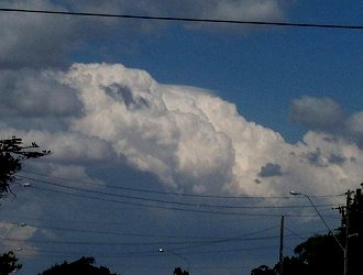
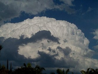
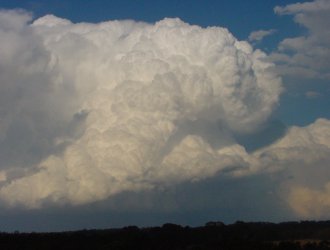
This developed into a Cb with mid level anvil (a characteristic of most storms on this day) in no time. A quick trip home to download the pictures i had just taken releaved an email to the aussie-weather list from John Woodbridge stating "explosive Cb development" in the SW suburbs of Brisbane. All signs were pointing to "big ass storms" later in the day, and to say i was excited would be an understatement. They sky around my location became cluttered with mid level anvils for well over an hour, but hard and/or boiling updrafts were still visible through gaps in the cloud. Soon a well organised base appeared to my NW. This base persisted for over 45 minutes, becoming raggid and dissorganised at times, only to become smoother and more organised time and time again.
The area of congestus passed just to the north of my viewing location, and i only recieved a small amount of tiny hail and some very large raindrops. As it continued to move SE the back end become obscured by cloud, and i decided to head home and downlod the pictures i had taken off my digital camera. On the way home i stopped at a set of lights, observing a storm to my south, when i glanced in my view vision mirror - BOOM!!!! THERE SHE BLEW!!!!!! The area of congestus had EXPLODED into a full blown storm - with boiling updrafts and a 'dome' appearance to the whole storm.
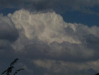
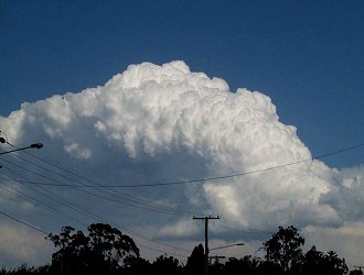
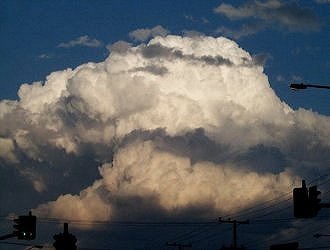
I took lots... and lots... and LOTS of pictures of this storm - after a poor storm season last year, and nothing but coastal Cb's and congestus for the last 6 months, this storm was just awesome. I scooted off home to download the pictures i had taken. While the pictures were downloading, a great Cb was developing to my south.
This Cb barely even showed up on Radar, and before long it had dissipated. Once my pictures had downloaded off the cam, i took off for one of my lookouts again. When i got there i observed quite a spectacular storm to the south somewhere between Brisbane and the Gold Coast. I don't have a tripod yet, and my digital zoom pictures (it was some distance away, and the low to medium tops made it look twice as far away) didn't turn out very well, but Ross Portas and Jason Rainforest managed to get some spectacular shots of this storm.
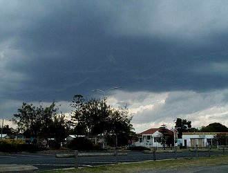
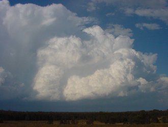
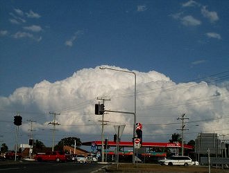
After an hour or so i decided to head back home and see what was on radar. All storms on this day were moving from the NW towards the SE, and throughout the day i had congestus/vertical development to my NW, with a constant stream of storms developing close to or just SE of Redcliffe. I observed some grunty congestus and rippled bases for another hour or so before having some lunch. I wasn't in the kitchen for long! 10 minutes later i looked towards the SE only to see another storm exploding into action.
I observed this storm, and other storms to the south, for about an hour or so. Again i headed back home to see what was on radar, and to see how the other Brisbane people were doing. During this time i was keeping a close eye on another rippled base moving in from the WNW. Before long this too quickly developed into a storm.
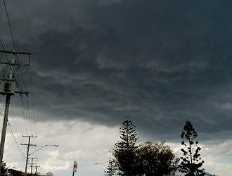
By this time my digital camera had smoke pouring off it i was taking that many pictures <g> I drove around Redcliffe switching between lookouts for a while, observing many areas of congestus and rippled bases - none of which eventuated into storms. It was now getting quite late, and i drove towards a lookout facing west to take some sunset pictures. Some congestus caught my eye, and i soon turned around to head for an eastern facing lookout. The base of this congestus quickly became quite 'curved' , almost round looking.
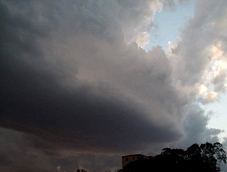
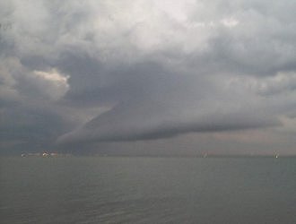
While photographing this (remember there is a hyperlink to a picture series above, showing all the pictures i took) i noticed an interesting base feature to my SSE. I have often seen roll clouds or spectacular shelf clouds off the SE coast of Redcliffe, and i didn't have to think too much before jumping in the car and heading south. Although there is rarely heavy trafic in Redcliffe, you can bet that if there is, i'll find it, and i'll be chasing a storm when i do. It took me a while to get to another lookout, but along the way there appeared to be a VERY long roll cloud extending NW from a cell to my SSE. When i finally got to a decent lookout i was greated by a spectacular shelf cloud - which i might add was attacheed to a towering Cumulus! Yes i said towering Cumulus! (more commonly abbreviated as a Tcu).
The above pictures are not of the best quality, but the sun had set, i was zooming in (approx. 100-120mm) and i didn't have a tirpod with me, so they came out a little blurry. All in all it was an excellent day, and
i thoroughly enjoyed myself. With any luck this is just a taste of
what is to come this storm season.
Chase Report by Ben
Quinn
|