|
Two wall clouds and a funnel! October 25, 2000 I�d been trying to shuffle things off Wednesday to Friday for the past few days, I went into work for a bit on Tuesday to try and get the �non-essential, essential� items out of this way in a bid to get Wednesday off. Unfortunately, I still had to go into work � but was happy when I was able to leave just after 11am!!! During Tuesday the 24th of October, a line of severe thunderstorms had formed over the northern central area of NSW and southern central QLD. A line of thunderstorms also extended further south, to just east of Melbourne! So this was a very extensive band! An upper level trough and surface low had slowly moved southwards from the NT/QLD area and into NSW and Victoria. This was bringing flooding to much of Victoria, and bringing in a fair bit of surface moisture. The storms over northern central NSW and southern central QLD moved over the SE QLD area during Wednesday morning. This gave falls fairly widespread of about 10-20mm. The band was likely to clear during the morning, with thunderstorms forming behind it. And between 10 and 11am, it did just that! Just after 11am, CJ�s were developing to the west. I had to head home quickly first to do a few things before I left. My initial destination was to be Warwick, about 2hrs SW of Brisbane. However I thought that the CJ�s down there were a tad too junky for my liking, and I decided that for at least the time being, I�d stick with the Lockyer Valley region (45mins west of Brisbane) and move further south if I had to later during the day.
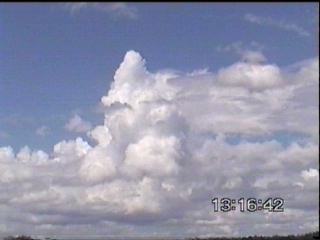
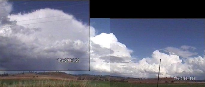
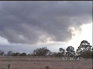
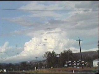
There was some ACCAS mixed in with the CJ�s, and the temp was 28 at around 12:30pm with a warm, moist NE�ly blowing through. I watched CJ�s go up and down, and slowly made my way to Laidley. At Laidley, the first cell of the day was visible to the NW. AM radio suggested the developing cells were quite lightning active, but there was also a fair bit of static from the storms out near Gundy. The cell to my NW developed quite quickly, and a nice flanking line developed.
I traveled up north to try and get closer. More cells developed to the SW of this one, they had some fairly strong winds in them judging by the rain feet it gave off! I was observing infrequently lightning at this stage, but noticed a few tinges of white in some of the rain shafts indicating hail. I tried to get closer, but got caught up in messy rain at the side of the storm! Some very large drops, and I thought I heard some hail on the roof of my car, but I wasn�t able to confirm this visually.
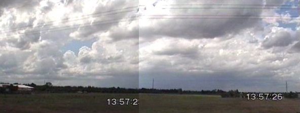
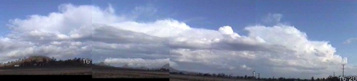
The cells while appearing strong, were actually not hugely photogenic near them, and they were getting quite messy with the rain. Despite being informed of a supercell to the north of this cell, I decided to head south. The chasing country in the Brisbane Valley is quite poor, the roads are windy and the terrain is hilly and there�s a lot of national parks and forests there. The CJ�s and TCU developing to the south had also caught my eye, and I headed back south.
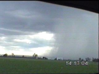
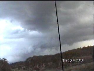
Unfortunately, what would have made a good chasing plan failed, as one of my wiper blades (the rubber part) fell apart in the heavy rain! :-( I had to try and find a new refill to fit, and did the rounds at Laidley. This basically lost me 45mins! Not to mention, I was almost in tears after having to argue with a Holden dealer to sell me some spare wiper blades while a cell to the NE formed a nice wall cloud with a prominent tail! It was short-lived, and my car (and camera equipment) was parked well up the road (and I thought the cities had parking problems!). I managed to get a makeshift wiper blade, and I was on my way. I headed east on the Warrego Hwy to try and catch the cells, but even though they were not very fast moving, I was not doing a good job catching up with them!
  I had to stop at Ipswich again to get proper wiper refills (ones that fitted properly!) And then headed south towards Cunningham�s Gap. I decided to go via Ipswich-Boonah Rd though to get a better view of things. Some very nice views of cells there, and some interesting weaker cells popped up to the west too!
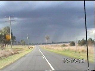
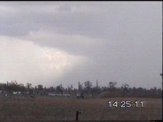
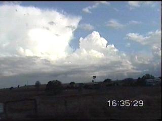
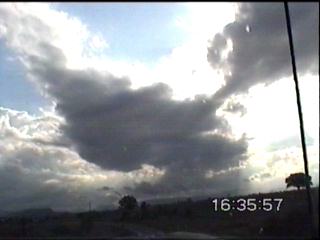
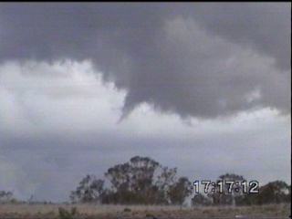
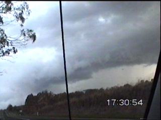
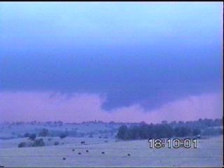
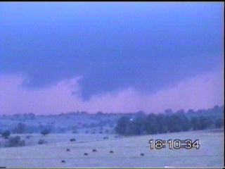
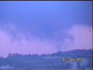
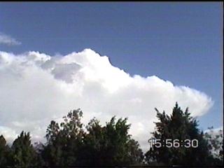
Around Cunningham�s Gap, I could see a large cell to the NE of Warwick, it looked quite nasty, and after narrowly avoiding the speed camera in the 80 zone, stopped just several kilometres to the west of Cunningham�s Gap. I stopped and videod another wall cloud on the NW side! I could see the guster further back, it was looking quite impressive! While watching the development, I started feeling quite faint watching a funnel descend from the wall cloud! Unfortunately, it did not eventuate into anything! (I�ve never actually seen a touch down!)
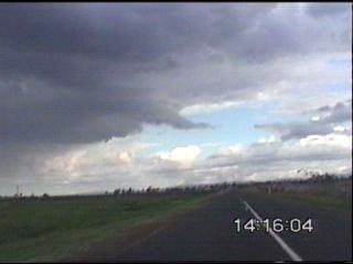
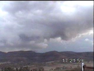
It was enough to make me do something silly, and head south on a soft dirt road, I just wanted to get over a hill and have a look. I observed the structure from another vantage point (not bad if the road is dry), before heading back towards Cunningham�s Gap. I observed a fairly spectacular guster formation though! Unfortunately, the area near Cunningham's Gap is quite hilly and foresty, and there are no real places to stop to take photos!
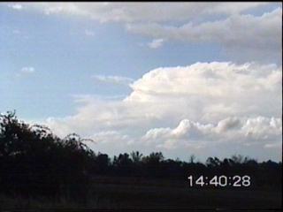
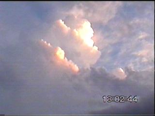
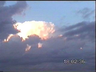
I decided to head for Boonah, as that�s where the cell would probably hit. There were some nice sunlit updrafts, and were certainly worth a pic or three!
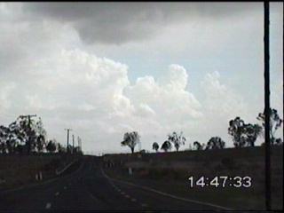
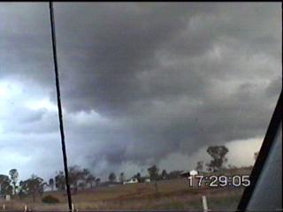
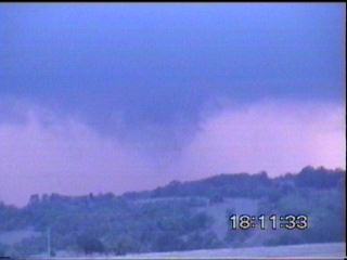
On the way to Boonah, I videod some very interesting lowerings in the main updraft an rear end of the cell and also videod a possible tornado!!! But I�m not sure, and at this stage to be conservative would probably just have to say it was moist inflow from the updraft. The cell had now changed direction and was moving at a 90 degree angle to all of the other thunderstorms in the area! Only the supercell 150km north of this region was also moving in the same direction (NE).
I reached Boonah, and there was lightning flickering and pulsing every few seconds with some nice thunder! I wanted to ride out the storm in Boonah, but I was worried about hail damage to the car. I was unable to find suitable hail shelter, so I was forced to continue to head ENE to Beaudesert. Lightning continued to flicker and pulse, and in about 25 minutes time arrived in Beaudesert. I headed to the southern outskirts of the town to watch a spectacular lightning show! The thunder was constant, you could hear up to two-three rumbles at a time! The occasional closer CG or CC bolt gave a nice clap of thunder. Unfortunately, rain was falling ahead of this cell, and I had to make a hasty retreat to shelter in Beaudesert. I missed a fantastic pink CG while fiddling around with the video camera tripod, but got some fairly bright and pulsey lightning on video tape (although very few bolts due to the rain). This cell was going to go to the north of Beaudesert, and after a long period of strong activity, had begun to weaken. I decided to head north, in the hope to get a closer intercept with the cell near Jimboomba. By the time I reached Jimboomba, the cell had weakened substantially, but was now dumping torrential rain. In fact, just to the north of Jimboomba the rain was so heavy I had to turn the wipers off, because all they were doing were splashing more water onto the windscreen! I crawled at about 10-20km/h (in a 100 zone) and put my hazard lights on so that any idiot driving too fast would not rear end me. I would have pulled over, but there were no safe places to pull over as the Mt Lindsay Hwy is little windy with a few blind spots and I could easily be swiped by a truck/car at night in torrential rain. There was a lot of water on the road, but fortunately this only lasted about two minutes at the most before finally subduing to the point where the wipers actually helped! After this, I decided to head home with generally most of the cells weakening to just give the odd CG or flicker of lightning. What a day though! There were reports of winds up to 80-90km/h from this cell (possible supercell), and the supercell in the Brisbane Valley gave hail large enough to injure cattle. Not sure on any other reports at the moment, no doubt there were quite a few severe thunderstorms about today, however due to the low population density, most of these were and will never be reported! Thanks to Dr Matthew Pearce and Daniel Weatherhead for updates!!!
Chase
Report by Anthony
Cornelius
|