
|
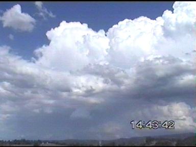
Tornado Chase Ends With Phenomenal Lightning Show! October 26, 2000 Thursday the 26th of October was shaping up to be another good day looking the satellite photos and the main surface trough to due to wander close later on that night. The previous days activity was certainly quite impressive! And today was certainly nothing short of phenomenal! The day was starting off quite warm, it was 31C just to the west of Brisbane after midday. However, there was a NW�ly blowing to the west of Brisbane (NE�ly along the coast). The NW�ly was dry, and slightly disconcerting, however the sky said it all with some nice ACCAS and CJ�s developing!
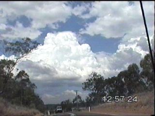
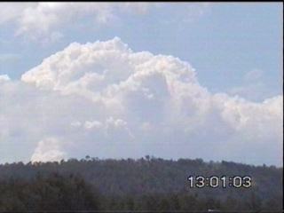
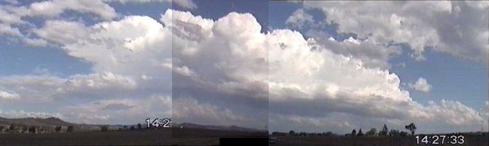
There were some very nice CJ development to the SW of Ipswich, and these eventually formed into the first cells of the day. They were quite low topped, and the first ones decayed earlier, however a new ling of CJ�s and TCU was developing to the SE and this was soon to turn into Cb�s.
I was driving down
Ipswich Boonah Rd, heading south towards Boonah and watching the line to
the SE. It was quite nice, while the tops were not overly high, they
were quite nice cells to watch! There was a bit of static on radio
too, it had died a little just before, but had picked up now.
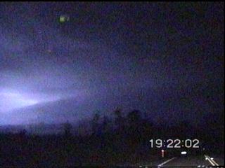
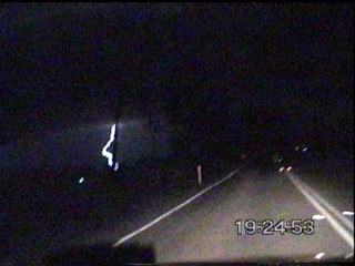
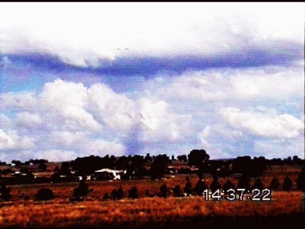
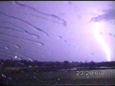
However, while coming around a corner, I viewed what I thought to be a tornado (a landspout to be exact! A non-supercellular tornado). A glance in the rear vision mirror, and the car screeched to a halt to get video footage! However, I was on the edge of an embankment, and there was no place to stop! I had to move along another 100m or so get into an open space where I could park in the middle of the road with the hazards on to take video footage! Fortunately, no traffic passed!
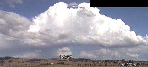
The tornado is difficult to see in the footage, and was unsure at the time if it was a tornado or a rain shaft! However, adjusting the contrast of the footage confirmed that it was in deed a tornado!!! This developed on the flank of a developing Cb to the ESE.
Click on the image above to see a report and more photos of this tornado!!! The Cb was actually developing on the seabreeze(?) NE�ly and the NW�ly convergence line! So this would have aided in local shear in the area. It lasted for about a minute while I had it in view, it was in deed quite exciting though!!!
I headed further south, keeping a close eye on any development of course! I decided to head east towards Beaudesert. When I got there, a thunderstorm had recently passed, it looked like it dumped a fair bit of rain over the region as I got there around fifteen minutes after a cell had gone through and there was still water running across the roads! A new CJ developed just overhead and began to give some drizzle, but there was another line of developing Cb�s to the south. It was 28.1C here with a DP of about 20C due to the recent precipitation.
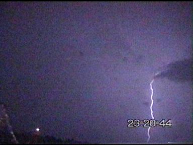
Quite hot and steamy! The Cb�s to the south were moving to the NE initially, and I was hoping that I�d intercept them if I headed east! However as the cells matured, they began to taken an E�ly path and they were going to go into an inaccessible part of the Gold Coast hinterland. I ended up heading back west to see Boonah to see if there was any other development. There was some distant anvils and convection to the SW, but at the time I didn�t think anything of it (stupid me!) And I actually began to head home. Just before I turned into my street, James gave me a call asking what the Cb�s to the SW were doing. I was surprised at this, but when I got off the phone to him, I saw that there were indeed anvils a lot closer to the SW! I walked in the door and watched radar for a few frames while recuperating a little. The cell that James was watching had intensified dramatically over the past thirty minutes with large areas of maximum intensity on radar! Another line of showers had come up from NE NSW and were heading towards the border ranges and these too were beginning to take off. I headed down on the M1 and was observing nearly constant lightning across the southern sky! I decided to head WSW at Beenleigh towards Beaudesert to get the cells that were rapidly developing and intensifying! Lightning was constant with several flashes a second at times! I was informed that a severe thunderstorm warning had been issued for these cells to the south of Brisbane.
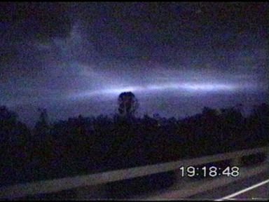
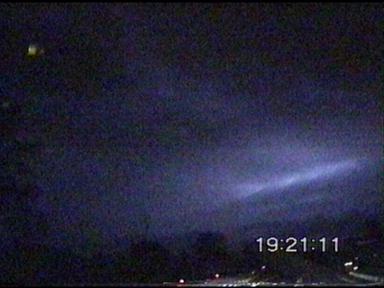
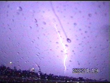
  As I got closer, the shelf cloud was absolutely phenomenal! The video footage I took while trying to drive does not show it very well, but every so often it would be lit up by lightning and it was just massive! I�d never actually seen something quite like it. If this storm had occurred during the day, the gust front on this would have no doubt been one of my most prized photos! Unfortunately, it was not to be! I got to Beaudesert and headed just out of town, 1km to the south to video lightning. James called me again, and he was on the other side of Beaudesert, so we met up and then headed back ENE to try and follow this cell. We then headed towards Canungra (south) to see if we could find another vantage point to take footage and photos at. Unfortunately we couldn�t find any! But we observed some spectacular lightning!!! There was some large puddles at Canungra, especially over the bridge! No doubt they would have copped quite a hiding. We decided that since we couldn�t find a suitable place to photograph the lightning due to the trees and ranges and took the back road towards the Gold Coast. There was some mud and rocks over the road in one place that indicated water flowing across it quite vigorously before! There also appeared to be the odd branch down, however it was difficult to tell as it was quite foggy, and the roads were still wet and the roads were quite windy! We got to Nerang at the back of the Gold Coast and decided to head back home. However, there were yet more storms now forming in the eastern Downs, and the Lockyer and Brisbane valleys! I went home yet again, now very tired (around 11pm). The storms kept developing though! And the next major line was to the north, it looked like it�d pass just to the north of Brisbane, so I headed further north to intercept it! The lightning was once again spectacular, at one stage there were three simultaneous CG�s! CG�s were generally quite frequent at times, but came in bursts. Most of the CG�s were obscured by rain though! However they were lightning up the night as bright as day! While travelling north along the Bruce Hwy, the storm passed over and gave torrential rain and numerous close CG�s! They were going off like gunshots, with very loud booming claps of thunder to follow!
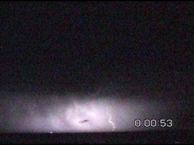
Click here to see a gif annimation of the middle left strike! It was difficult to drive in the torrential rain, hence couldn�t get much video footage. However just to the north of this cell, I found an advantage spot at a service station and pulled over to observe a few very nice CG�s on the northern edge! I sat and watched what was still a spectacular show, before heading towards Redcliffe. I wanted to be on the coast to video more lightning as the storms went out to sea! However, I had difficulty in finding a good spot with no trees (although I had found numerous before, I couldn�t find it when I really wanted it!) Hence missed numerous very nice CC�s as they spread and moved across the sky! Still, I managed to get some footage, and videoed the very frequent (average of 1-2 strikes per second) lightning out to sea! It was certainly spectacular, with the odd CG or CC bolt being visible!
It was around 12:15am, and after 13hrs and nearly 800km of chasing I was absolutely exhausted and since I had a 40min drive home I thought that I�d better drag myself away from the storms (very difficult to do), so that I would not be too tired to drive back home. However, on the way back south, I noticed yet more lightning increasing in frequency to the south! Radar indicated yet another line of strong and possibly severe thunderstorms forming over the border ranges and moving over the Gold Coast again! However, I was very tired and decided to let this one slip! I didn�t mind too much, as I didn�t think much could top the lightning that I�d already seen from the chasing that I�ve done! What a fantastic two days!!! It�s a shame Friday didn�t top it off, it was a chance however as a high ridged in, it pushed in drier SW�lies that stuffed everything up. However during the morning there was some spectacular CJ�s along the coast, and again just to the SW during the afternoon for a brief period of time! Great to see these
types of days returning!!! For me, it�s certainly been a great 2
weeks!!! A very happy and tired chaser here, getting my second tornado
for the season, and some great thunderstorms!!!
Thanks to Dr Matthew
Pearce and Matthew Smith for updates!!!
Chase
Report by Anthony
Cornelius
|


 \
\

