|
January 27, 2001 Temperatures across SE QLD were soaring into the 30's along the coast, and inland of Brisbane into the low 40's. DP's were in the low 20's for this day, and with a weak upper system nearby, more so due to the upper level low to our east. Tropical moist, NW to NE winds were fairly widespread, and there was a heat low and trough moving towards us. Unfortunately the upper level moisture levels were rapidly increasing, this would limit the amount of convection. Upper level winds were also fairly weak, so most storms moved slowly. But it looked like SE QLD would be in store for at least a couple days of thunderstorms.
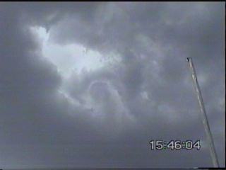
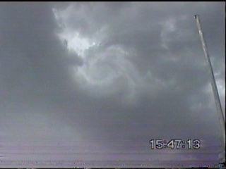
I had to head off to the farm to drop off my dog with my parents so that I could take the extra time to chase. After this I headed towards Cunningham Lookout to observe things. There were some nice cells in the Northern Tablelands region, as I headed towards Maryvale on the Cunningham Hwy to do some exploring. I noticed a few more substantial CJ's and storms starting to develop on the border ranges. A lot of other CJ's had gone up previously, but had collapsed, and were starting to clutter up the sky. I headed towards Boonah to get a closer view. There were cars by the side of the road all over the place from overheating in the 40C conditions! The extra humidity also didn't help. I noticed a few more cells develop on the way to Boonah, their development was very rapid, developing and precipitating in under ten minutes! But due to the slow low level winds, they couldn't survive as they sat on the ranges. At Boonah, I stopped at the lookout and to my amazement saw fairly strong rotation right above! It was nipple shaped, and the rotation was evident to the naked eye clearly. The rotation lasted several minutes before dissipating back into the cloud base. I observed several CG's from a storm to the SE, and decided to head further east to Beaudesert.
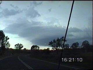
This storm had the warmest outflow I had ever felt! With the outflow temperatures still in the low 30's! It was quite weird actually, I was expecting a pleasant cool outflow, but far from it! Along the edge, I experienced sporadic light to heavy rain with gusty winds � nothing severe, but a few small branches did come off trees, mostly dead branches though. After this part, I experienced some heavy rain before exiting the storm and continuing eastwards as the storm moved NE. I observed an interesting feature towards Beaudesert, but it was just an outflow feature.
I sat at Beaudesert
for a bit and watched some occasional CG's, but it was apparent that everything
was flattening out into thundery rain, so I decided to drive back home
watching occasional lightning strikes light up the area. When I got
home it was a steamy 27/24! Shame no further storms developed though.
Chase
Report by Anthony
Cornelius
|