|
WINTER STORM CHASE
- WEATHER GODS BLESS SE QLD AND NE NSW WITH
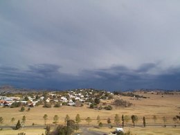
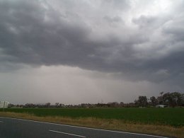
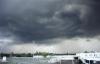
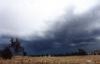
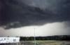
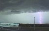
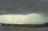
A strong upper level trough caused widespread showers and storms to develop in SE QLD and NE NSW Monday, July 10. Storms developed very quickly SW of Brisbane early in the afternoon, and before long the BOM issued a Severe Thunderstorm warning.
An extensive line of activty developed soon after, and gradually moved east. This line did spread out into rain with embedded thunderstorms, but remained quite lightning active. No severe weather has been reported from the Brisbane Metro area, but there were reports of hail and strong winds in other districts (see below). 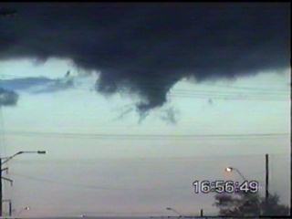
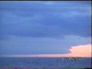
Click here or on the above stills for Anthony's chase report for this day
Summary of Significant Observations and Reports Hail was reported at Kingaroy and Gin Gin. Hail double the size of Golf Balls (storm spotter report) was also reported from the Woodford area. A severe wind gust of 52knots (just over 90km/h) was reported from Emerald in the Central Highlands and Coalfields district. An interesting report came in from an ASWA member a few days later! Here's a brief summary: Craig Williams (ASWA QLD) phoned Anthony Cornelius yesterday to inform me about an interesting event. He commented on the frequent and relatively close CG's that occurred. Of most importance, was the CG that struck a tree about 10m from his house!!! He said that he heard a large buzzing noise before the strike, then the flash and instantaneous and very loud crack! Craig mentioned that it appears the water inside of the tree boiled and exploded looking at the tree, he also noted that there were bits of bark impaled into the ground. The damage? A fried network card to the cable modem...one would automatically assume that the strike got into underground cabling - but, his cable modem is fine, and the same with his cable television decoder (all on the same line)...all perfectly fine! I would have expected the modem, the decoder, TV, Computer etc all to explode, or at least be damaged! Significant Rainfall Totals in SE QLD and NE NSW to 9am Tuesday, July 11 SE QLD Glenlyon Dam - 24mm
Heron Island in the Capricornia district also scored 34mm. NE NSW Cape Byron - 21mm
Report by Ben Quinn
|