
|
SEVERE THUNDERSTORMS LASH SE QLD - JANUARY 27 and 28, 2001 Humidity levels soared in SE QLD on Saturday (Jan 27) and Sunday (Jan 18) as a trough system approached from central Australia. In an around Brisbane, dew points of between 20c and 25c were a reminded of just how sultry it can be in January/February. Severe thunderstorms developed on both days. On Saturday a large storm complex moved off the SE QLD/NE NSW border ranges, moving north at first and then NE towards the southern suburbs of Brisbane. It spread out into thundery rain as approached, but not before causing tree damage and blackouts in the town of Beaudesert, SW of Brisbane. Storm chasers Jason Rainforest and Ben Quinn took the following photos from Brisbane during the afternoon. The first was taken by Jason from Pimpama looking SW - this cell was actually moving NE away from the main complex of storms at a rate of 75km/h! Which was almost 3 times as fast as most other storms on that day, and all the storms around it at the time. The second was taken by Ben Quinn from Redcliffe mid afternoon, looking west towards the Esk area. 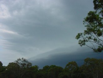 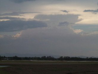 Click on the above thumbnails to see full
size versions
Click on the above thumbnails to see full
size versions
Storm Chaser Anthony Cornelius was out chasing on this day, spotting a possible funnel (first capture below) seen from almost directly under it, and also the same gust front as the one photographed above by Jason Rainforest , but from a different angle. 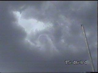 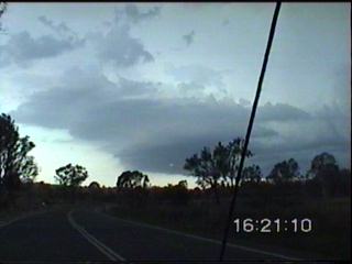 Click here or on the above stills to go to Anthony's chase report for this day There are also unconfirmed reports of several tornadoes seen from Toowoomba at approximately 6:30pm in the evening. Unfortunately there is no more information about this report. Showers and thunderstorms continued to develop throughout the night in the Darling Downs and Grannite Belt and the Wide Bay and Burnett districts, with an intense electrical storm developing over Dalby just after 11pm. Click here for a small lightning tracker loop showing this storm (40kb). On Sunday showers
and thunderstorms developed throughout SE QLD, with several severe cells Click on the above lightning tracker image to see a small loop (95kb). Unfortunately the image showing 1996 whites was not cached properly, but it will be added to the loop as soon as i track it down! One resident at Cinnibar (approx 40 minutes drive WNW of Gympie) recorded 15mm in 2 minutes from a storm - a rain rate of 450mm/h! Severe winds and lightning brought down numerous trees in this area. In southern parts of SE QLD showers and thunderstorms developed from early afternoon onwards - with several strong and lightning active cells. I managed to catch up with a cell around the Dayboro area early in the afternoon, unfortunately as i approached it began weakening. 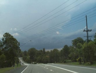 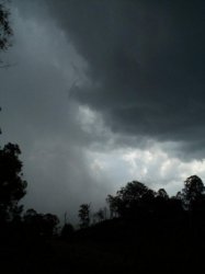 Click on the above thumbnails to see full size versions Anthony Cornelius was out chasing again on this day. Anthony reported flash flooding south of Laidley, with over 40cm's of water over the road in one area. 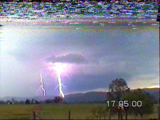 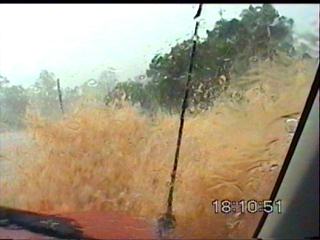
Click here or on the above stills to read Anthony's chase report Radar images during the evening showed a very slow moving storm around this same area, with high rainfall intensities over the area for almost 2 hours! The highest reported fall to date was 78mm (possibly in one hour) near Grandchester. Adam Cole from Warwick has provided the following summary of the day
Report by Ben Quinn
|