SHOWERS AND THUNDERSTORMS
- NOVEMBER 27, 2000
A combination between a surface and an
upper level trough caused showers and storms to develop on the ranges in
NE NSW and SE QLD on this day. Some of these were quite intense,
with 100mm/h+ intensities on radar indicating the possibility of hail,
or at least very heavy rain. One complex in SE QLD late in the day,
N and NE of Warwick, showed 100mm/h+ intensity for 1 hour.
Hail was reported from this complex, although the size was unknown at the
time this report was written.
Adam
Cole from Warwick has provided this summary of the days
events.
Looking at the weather report
for toady showed only a possible shower in the district, and early morning
was about the same as monday, cool early but heating up quickly. This morning
was very humid and hot and they day just got worse. With no significant
cloud I resigned myself to a boring day. The forecast wasn't right and
the atmosphere looked too stable for decent development. About 12:30
PM Warwick was struck by a rogue bolt of lightning and the deafening boom
echoed around.
But half an hour later a storm development
started in earnest. To the SSE a line of storms developed and slowly
moved over us the whole time building. Massive CG's were observed and what
looked to be a shelf cloud trying to form in several places. In the space
of half an hour it had gone from isolated showers to a line of storms (or
one big storm) and it looked to have a tiny amount of rotation in
it from my perspective. Thunder was heard up to every 10 seconds with visible
CG's. The rain came and was extremely heavy for a period of ten minutes
probably dumping about 15mm in East Warwick where I was but only 8mm at
my home 4 km west. This storm moved NNW which was very unusual and proves
to be a significant factor here in producing severe storms. Hail was reported
to the north and the structure of the storm would have made this likely.
BOM warnings said this storm was severe
as passing through Allora at about 3:30PM and the Warning was issued for
Toowoomba. Visible also was another storm after this had passes to the
SW which passes well to the West of Warwick
I was able to take some photos of
this complex after it passed over Warwick, and intensified dramatically.
These were taken at the same time hail was falling.
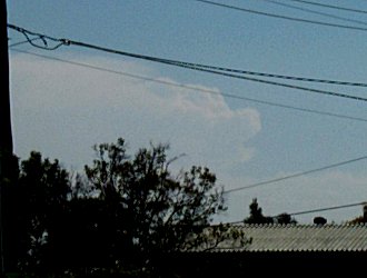 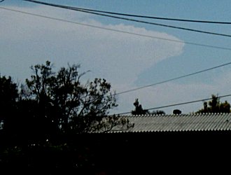 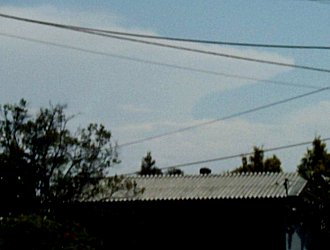
Sorry about the poor quality, they were
taken using digital
zoom, so no full size versions are available.
In NE NSW, a tornado struck the smalll
town of Boggabri, causing significant damage to houses and sheds.
Information courtesy of Adam
Cole has been posted on the Australian
Severe Weather site, click here
to go to the report.
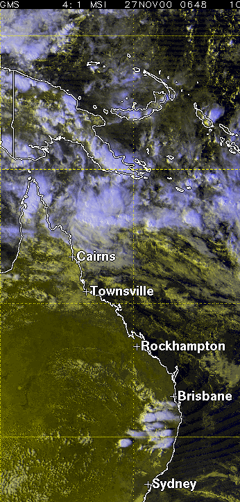
Data for this
day
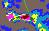
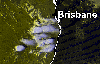
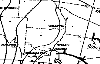
In order of appearance : Brisbane
local scale radar event loop (180k), Energex lightning tracker loop (50k),
VIS satellite picture (155k), 500mb analysis (50k), 200mb analysis (50k),
MSLP analysis (17k)
|