|
SEVERE HAILSTORMS - NOVEMBER 4, 2000
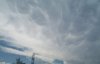
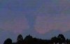
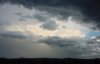
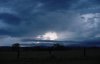
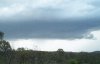
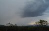
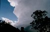
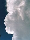
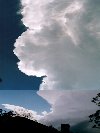
During the mid afternoon a storm developed around the Crows nest area WNW of Brisbane, and split. One cell moved in a general northerly direction, while another moved ESE towards Ipswich and the western suburbs of Brisbane, with both cells showing constant high intensities on radar. The right moving supercell was quite spectacular, with crisp hard updrafts and a huge backshear.
Jason Rainforest and Ben Quinn were also chasing on this day, and caught up with this cell NW of Ipswich. A chase report will be written up ASAP, but in the meantime the following pictures are available. 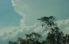 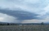 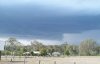
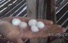
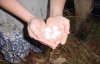
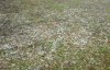
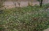
  Anthony Spierings also managed to take some pictures of this storm from eastern Brisbane around 2:30pm. 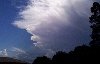 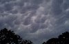 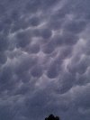 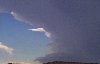 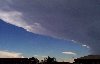 Late in the afternoon a large storm developed SE of Gatton, dumping golf ball sized hail (report courtesy of the Weather Company ), and moved SE towards Beaudesert. Anthony Cornelius, Jason Rainforest and Ben Quinn all experienced this storm, with hail up to 3.5cm and strong winds.
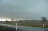
This cell continued to move SE, before dissipating around Beaudesert, where 2cm hail and minor flash flooding was reported John
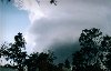
Woodbridge photographed a storm approaching his house during the afternoon, which dropped hail up to 2.5cm in size at his location (Mt Crosby).
After the last few days having shower and storm build up,
Saturday proved to be a very interesting day. With the day being fairly
hot and humid, much cloud developement was observed for the entire day.
About mid afternoon, most developement was taking place to the east and I
was rather disappointed. Several more times throughout the afternoon I
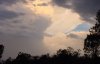
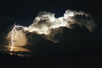
rechecked the sky and much the same story unfolded. At 7:25 pm that all changed with me hereing some thunder. I looked outside again and noted several areas of lightning, ENE, NW and S. Over the next 30 mins the storms converged over my head. Or so it seemed. For 2 hours, I was treated to one of the biggest lightning shows I have ever seen. Most of the lightning observed was CG with 40% of the blots being clearly visible and therefore perfect for photography. (Photos are yet to be posted.) The lightning was extremely intense with bolts being seen every second. During this time I also witnessed 2 futher cells build up on the NW of these previous cells and the lightning provided amazing detail of the cloud structure several times during the night. At 11 pm another storm hit Warwick with reports of intense rainfall and lightning ( I feel asleep) and at 3 am Sunday morning another storm hit Warwick. This one woke me up with more intense lightning. An inch was dumped during the night and severe hail damage reported around Stranthorpe and Severnlee. An amazing night and one to be remembered. It's times like these I wish I had a video camera.
NE NSW storm chaser Michael Bath was chasing on this day, click here or on the photos below to see his report. 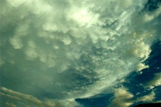
2-3cm hail reported at Hiddenvale, reported to "cover the ground," 39mm in 35mins, but hail blocked up the rain guage so it could have been a fair bit more. No wind. (report courtesy of Anthony Cornelius' parents) Significant AWS observations Cape Moreton recorded a rain rate of 51.6mm/h
at 9pm.
Credits
Thanks to Anthony Cornelius (QLD ASWA) for archiving the above data, and Laurier Williams, who provides the significant AWS observations used in this report on his website - Australian Weather News and Links. Report by Ben
Quinn
|